Faculty Profile : Dr. Neelima Satyam
Civil Engineering
GEOTECHNICAL APPLICATION TOOLS DEVELOPED
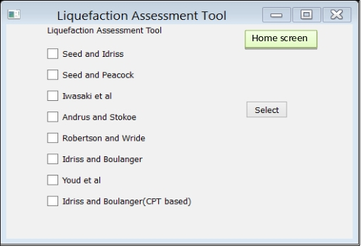
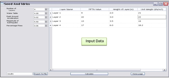
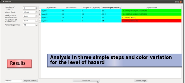
- LIQUEFACTION ASSESSMENT TOOL:
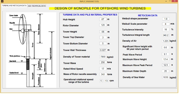
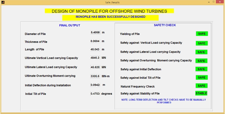
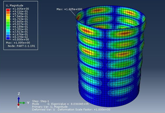
- SDMWT: Tool for Seismic Design of Monopile for Offshore Wind Turbine:
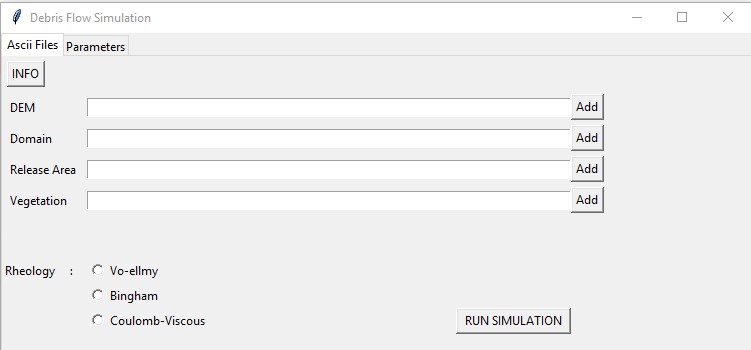
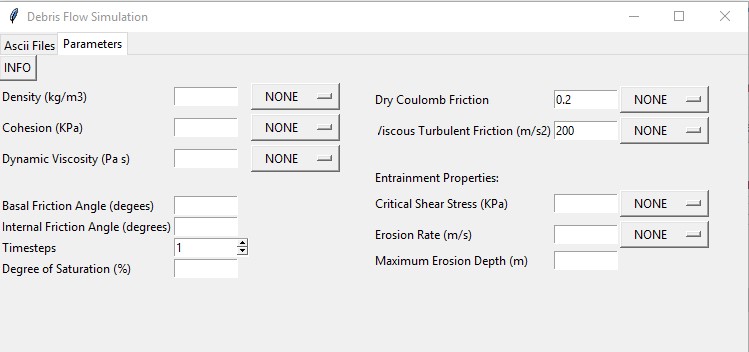
- Debris Flow Model
- RockMetrics:
- Risk assessment in regional scale: Tool for analyzing land use changes
Liquefaction is a phenomena in which when loose, cohesion less, saturated soils in undrained condition when subjected to earthquake loading or dynamic loads behave like a fluid due to subsequent loss of shear strength and increase in pore water pressure. The effect of liquefaction can be predicted in three stage: Evaluation of Susceptibility, hazard and deformations. Currently, a tool has been developed for the assessment of liquefaction hazard. Many different methods are available for the assessment of liquefaction hazard but the stress based approach has been chosen for the development of the tool.
SDMWT is a computing tool designed as Graphical user Interface on the base of C language which serves as a computer application. This application is used for the "Seismic Design of Monopile for Offshore Wind Turbines". Considering Geo technical data along with met-ocean and Turbine data dimensions of a monopile are designed under seismic, lateral and gravity loading conditions for site specific environment. Outstanding part of the application is that it generates a 3D animated view of a monopile that gives stress distribution generated on the basis of Finite element modelling.
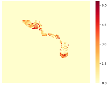
A numerical model has been developed to predict the runout distance and flow parameters of debris flows using Finite Difference Approach. The approach is based on continuum concept with mass and momentum conservations as governing equations. The model is able to predict the shape and volume of debris flows with variation of height and velocity with respect to time and space during the flow. The model takes into account multiple rheologies, effect of land cover and different degrees of saturation.
RockMetrics is a mobile application for rock slope failure detection. The application contains a data collection tab which can be further modified as per the requirements of user. Currently it collects the location, date, material, type of land affected, chances of reactivation etc, and the provisions for adding images and videos will be added soon. Along with the data collection, this app can be used for rock mass characterization, and detection of type of failure which can be highly useful in adopting adequate mitigation measures, particularly along the road corridors. The joints are detected using image processing, and the rock type is identified using pre trained images. Based on minimum user inputs, the application calculates the probability of failure of the rockmass along the joints The app is now available in play store and we are making necessary changes to make this completely free. When a landslide or rockmass photograph is taken, it retrieves the data from the national scale LSMs and displays the landslide susceptibility of that location.
Recognising the need for an innovative approach for extracting LULC information, the tool uses random forest (RF) classifier, that automatically generates LULC classification maps based on natural colour satellite imagery without any training input from the end-user. The pre-trained model is used to build a simple and user-friendly tool that automatically generates and visualises the LULC classified Geo-referenced TIFF (GeoTIFF) file corresponding to any inputted true colour satellite image/ Google Earth image without the support of any additional training input from the end-user.